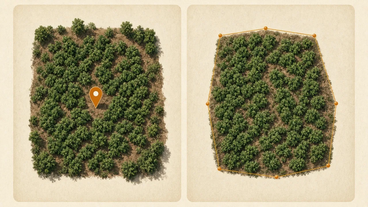
When recording where an agricultural product comes from, knowing the farm’s location is an important first step. But depending on the plot and applicable requirements, a single location point may not be enough.
Under the EU Deforestation Regulation (EUDR), geolocation requirements distinguish between identifying a location and describing the perimeter of a plot. Understanding this difference matters for organisations collecting, managing or providing origin information to buyers.
When Is a Point Enough?
A geolocation point uses coordinates to identify a specific location. It marks a place on a map but does not describe the full area surrounding it.
The EUDR definition of geolocation specifies that coordinates must contain at least six decimal digits. For relevant commodities other than cattle, plots larger than four hectares used for production must be geolocated using polygons that describe their perimeter.
A point can therefore be enough for a plot of four hectares or less, and for cattle, where the applicable rules call for a location rather than a perimeter. The appropriate method depends on the plot and the requirements that apply.
When Does a Plot Need a Boundary?
A polygon uses a sequence of coordinate points to outline an area. Rather than marking a single location, it describes the plot’s perimeter.
When capturing a boundary, the objective is to represent the actual plot as accurately as possible. The outline should follow the plot’s edges instead of cutting across the land or leaving gaps that make the shape unclear.
What Can Make a Plot Boundary Invalid?
Errors during data collection or entry can affect the accuracy and usefulness of a boundary. Common issues to check include:
- Crossing lines: The boundary crosses itself, creating an unclear shape.
- An open boundary: The perimeter is incomplete where a closed polygon is required.
- Too few points: The recorded coordinates do not adequately describe the plot’s shape.
- Incorrect coordinate order: Latitude and longitude are swapped, potentially placing the plot in the wrong location.
- Unexpected overlaps: Neighbouring plots overlap in ways that may require review.
- Insufficient precision: Coordinates do not meet the applicable precision requirements.
These are practical data-quality checks, not an exhaustive list of formal EU Information System validation rules. Verify the applicable technical specifications, including the European Commission’s EUDR implementation guidance, before publication or regulatory use.
How Can You Capture a Plot Boundary Accurately?
Walk around the plot’s edge in one direction, pausing at each corner long enough for the GPS reading to settle before recording the point. Follow the actual perimeter rather than cutting across the land.
Once the capture is complete, review the outline for crossing lines, gaps, misplaced points and unexpected overlaps. Identifying issues during capture can make it easier to correct the record before it is needed.
Why Does Plot Geolocation Matter for Traceability?
For cooperatives, aggregators and exporters working with produce from multiple farms, agricultural traceability often depends on plot information connecting to the relevant lot and shipment. Accurate capture establishes the geographical starting point, while organised origin records help preserve the connection as produce moves through the supply chain.
Origin Secure is designed around origin information and its connection to the wider supply chain. A walkthrough can help organisations explore the workflow and determine whether it fits their operational needs.
Key Takeaway
A point marks a location. A polygon describes a perimeter. Knowing when each is appropriate helps organisations capture clearer origin information and understand the geolocation requirements that apply to their operations.
How does your organisation currently record plot locations: with a single point, a boundary, or both?